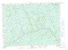
Maps showing East Branch Lake, Northumberland, New Brunswick
East Branch Lake is a Lake located in Northumberland, New Brunswick and has an elevation of 230 meters.
- Latitude: 46° 36' 24'' North (decimal: 46.6065630)
- Longitude: 66° 30' 53'' West (decimal: -66.5146293)
- Topography Feature Category: Lake
- Geographical Feature: Lake
- Canadian Province/Territory: New Brunswick
- Elevation: 230 meters
- Location: Northumberland
- Atlas of Canada Locator Map: East Branch Lake
- GPS Coordinate Locator Map: East Branch Lake Lat/Long
East Branch Lake NTS Map Sheets