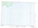
Maps showing Evans Cove, Saint John, New Brunswick
Evans Cove is a Bay located in Saint John, New Brunswick and has an elevation of 38 meters.
- Latitude: 45° 14' 37'' North (decimal: 45.2435643)
- Longitude: 65° 49' 38'' West (decimal: -65.8272907)
- Topography Feature Category: Bay
- Geographical Feature: Cove
- Canadian Province/Territory: New Brunswick
- Elevation: 38 meters
- Location: Saint John
- Atlas of Canada Locator Map: Evans Cove
- GPS Coordinate Locator Map: Evans Cove Lat/Long
Evans Cove NTS Map Sheets