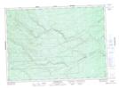
Maps showing Mains Lake, Northumberland, New Brunswick
Mains Lake is a Lake located in Northumberland, New Brunswick and has an elevation of 349 meters.
- Latitude: 46° 56' 19'' North (decimal: 46.9386474)
- Longitude: 66° 28' 29'' West (decimal: -66.4746593)
- Topography Feature Category: Lake
- Geographical Feature: Lake
- Canadian Province/Territory: New Brunswick
- Elevation: 349 meters
- Location: Northumberland
- Atlas of Canada Locator Map: Mains Lake
- GPS Coordinate Locator Map: Mains Lake Lat/Long
Mains Lake NTS Map Sheets