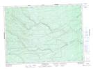
Maps showing Maple Hill, Northumberland, New Brunswick
Maple Hill is a Mountain located in Northumberland, New Brunswick and has an elevation of 173 meters.
- Latitude: 46° 56' 49'' North (decimal: 46.9470095)
- Longitude: 66° 1' 39'' West (decimal: -66.0275075)
- Topography Feature Category: Mountain
- Geographical Feature: Hill
- Canadian Province/Territory: New Brunswick
- Elevation: 173 meters
- Location: Northumberland
- Atlas of Canada Locator Map: Maple Hill
- GPS Coordinate Locator Map: Maple Hill Lat/Long
Maple Hill NTS Map Sheets