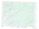
Maps showing Iron Bound Cove, Queens, New Brunswick
Iron Bound Cove is a Bay located in Queens, New Brunswick and has an elevation of 14 meters.
- Latitude: 46° 8' 27'' North (decimal: 46.1407938)
- Longitude: 65° 56' 56'' West (decimal: -65.9489723)
- Topography Feature Category: Bay
- Geographical Feature: Cove
- Canadian Province/Territory: New Brunswick
- Elevation: 14 meters
- Location: Queens
- Atlas of Canada Locator Map: Iron Bound Cove
- GPS Coordinate Locator Map: Iron Bound Cove Lat/Long