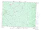
Maps showing Island Lake, Northumberland, New Brunswick
Island Lake is a Lake located in Northumberland, New Brunswick and has an elevation of 255 meters.
- Latitude: 47° 16' 9'' North (decimal: 47.2691316)
- Longitude: 66° 0' 13'' West (decimal: -66.0034881)
- Topography Feature Category: Lake
- Geographical Feature: Lake
- Canadian Province/Territory: New Brunswick
- Elevation: 255 meters
- Location: Northumberland
- Atlas of Canada Locator Map: Island Lake
- GPS Coordinate Locator Map: Island Lake Lat/Long
Island Lake NTS Map Sheets