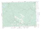
Maps showing Parker Ridge, York, New Brunswick
Parker Ridge is a Unincorporated area located in York, New Brunswick and has an elevation of 215 meters.
- Latitude: 46° 27' 21'' North (decimal: 46.4559125)
- Longitude: 66° 30' 56'' West (decimal: -66.5154406)
- Topography Feature Category: Unincorporated area
- Geographical Feature: Dispersed Rural Community
- Canadian Province/Territory: New Brunswick
- Elevation: 215 meters
- Location: York
- Atlas of Canada Locator Map: Parker Ridge
- GPS Coordinate Locator Map: Parker Ridge Lat/Long
Parker Ridge NTS Map Sheets