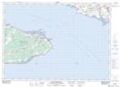
Maps showing Peacock Point East, Westmorland, New Brunswick
Peacock Point East is a Cape located in Westmorland, New Brunswick and has an elevation of 1 meters.
- Latitude: 46° 9' 14'' North (decimal: 46.1538577)
- Longitude: 63° 51' 32'' West (decimal: -63.8590173)
- Topography Feature Category: Cape
- Geographical Feature: Point
- Canadian Province/Territory: New Brunswick
- Elevation: 1 meters
- Location: Westmorland
- Atlas of Canada Locator Map: Peacock Point East
- GPS Coordinate Locator Map: Peacock Point East Lat/Long
Peacock Point East NTS Map Sheets