Maps showing Pentland Gulch, Gloucester, New Brunswick
Pentland Gulch is a Valley located in Gloucester, New Brunswick and has an elevation of 229 meters.
- Latitude: 47° 25' 51'' North (decimal: 47.4309458)
- Longitude: 66° 0' 5'' West (decimal: -66.0014021)
- Topography Feature Category: Valley
- Geographical Feature: Gulch
- Canadian Province/Territory: New Brunswick
- Elevation: 229 meters
- Location: Gloucester
- Atlas of Canada Locator Map: Pentland Gulch
- GPS Coordinate Locator Map: Pentland Gulch Lat/Long
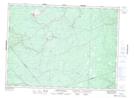
Pentland Gulch NTS Map Sheets