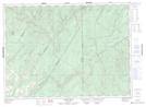
Maps showing Violette Brook, Victoria, New Brunswick
Violette Brook is a River located in Victoria, New Brunswick and has an elevation of 228 meters.
- Latitude: 47° 21' 00'' North (decimal: 47.3499591)
- Longitude: 67° 40' 2'' West (decimal: -67.6673541)
- Topography Feature Category: River
- Geographical Feature: Brook
- Canadian Province/Territory: New Brunswick
- Elevation: 228 meters
- Location: Victoria
- Atlas of Canada Locator Map: Violette Brook
- GPS Coordinate Locator Map: Violette Brook Lat/Long
Violette Brook NTS Map Sheets