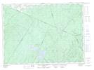
Maps showing McGee Brook, Victoria, New Brunswick
McGee Brook is a River located in Victoria, New Brunswick and has an elevation of 260 meters.
- Latitude: 47° 18' 31'' North (decimal: 47.3086557)
- Longitude: 67° 22' 19'' West (decimal: -67.3719834)
- Topography Feature Category: River
- Geographical Feature: Brook
- Canadian Province/Territory: New Brunswick
- Elevation: 260 meters
- Location: Victoria
- Atlas of Canada Locator Map: McGee Brook
- GPS Coordinate Locator Map: McGee Brook Lat/Long
McGee Brook NTS Map Sheets