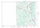
Maps showing McGrath Corner, Carleton, New Brunswick
McGrath Corner is a Unincorporated area located in Carleton, New Brunswick and has an elevation of 188 meters.
- Latitude: 46° 29' 7'' North (decimal: 46.485239)
- Longitude: 67° 43' 50'' West (decimal: -67.7305402)
- Topography Feature Category: Unincorporated area
- Geographical Feature: Dispersed Rural Community
- Canadian Province/Territory: New Brunswick
- Elevation: 188 meters
- Location: Carleton
- Atlas of Canada Locator Map: McGrath Corner
- GPS Coordinate Locator Map: McGrath Corner Lat/Long
McGrath Corner NTS Map Sheets