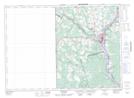
Maps showing Pine Island, Carleton, New Brunswick
Pine Island is a Island located in Carleton, New Brunswick and has an elevation of 63 meters.
- Latitude: 46° 11' 44'' North (decimal: 46.1956603)
- Longitude: 67° 32' 11'' West (decimal: -67.5365077)
- Topography Feature Category: Island
- Geographical Feature: Island
- Canadian Province/Territory: New Brunswick
- Elevation: 63 meters
- Location: Carleton
- Atlas of Canada Locator Map: Pine Island
- GPS Coordinate Locator Map: Pine Island Lat/Long
Pine Island NTS Map Sheets