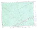
Maps showing Lake of the Plains, Northumberland, New Brunswick
Lake of the Plains is a Lake located in Northumberland, New Brunswick and has an elevation of 121 meters.
- Latitude: 46° 35' 16'' North (decimal: 46.5878802)
- Longitude: 66° 12' 49'' West (decimal: -66.2137102)
- Topography Feature Category: Lake
- Geographical Feature: Lake
- Canadian Province/Territory: New Brunswick
- Elevation: 121 meters
- Location: Northumberland
- Atlas of Canada Locator Map: Lake of the Plains
- GPS Coordinate Locator Map: Lake of the Plains Lat/Long