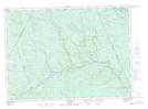
Maps showing Lambert Falls, York, New Brunswick
Lambert Falls is a Falls located in York, New Brunswick and has an elevation of 256 meters.
- Latitude: 46° 37' 19'' North (decimal: 46.6219084)
- Longitude: 66° 44' 58'' West (decimal: -66.7493343)
- Topography Feature Category: Falls
- Geographical Feature: Falls
- Canadian Province/Territory: New Brunswick
- Elevation: 256 meters
- Location: York
- Atlas of Canada Locator Map: Lambert Falls
- GPS Coordinate Locator Map: Lambert Falls Lat/Long
Lambert Falls NTS Map Sheets