Maps showing Loggie Lodge, Northumberland, New Brunswick
Loggie Lodge is a Unincorporated area located in Northumberland, New Brunswick and has an elevation of 325 meters.
- Latitude: 46° 58' 11'' North (decimal: 46.9698412)
- Longitude: 66° 31' 49'' West (decimal: -66.530406)
- Topography Feature Category: Unincorporated area
- Geographical Feature: Locality
- Canadian Province/Territory: New Brunswick
- Elevation: 325 meters
- Location: Northumberland
- Atlas of Canada Locator Map: Loggie Lodge
- GPS Coordinate Locator Map: Loggie Lodge Lat/Long
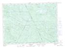
Loggie Lodge NTS Map Sheets