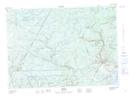
Maps showing Long Island, Sunbury, New Brunswick
Long Island is a Island located in Sunbury, New Brunswick and has an elevation of 82 meters.
- Latitude: 46° 5' 54'' North (decimal: 46.0984615)
- Longitude: 66° 17' 58'' West (decimal: -66.2994855)
- Topography Feature Category: Island
- Geographical Feature: Island
- Canadian Province/Territory: New Brunswick
- Elevation: 82 meters
- Location: Sunbury
- Atlas of Canada Locator Map: Long Island
- GPS Coordinate Locator Map: Long Island Lat/Long