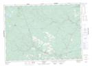
Maps showing Louies Pup Rapids, York, New Brunswick
Louies Pup Rapids is a Rapids located in York, New Brunswick and has an elevation of 239 meters.
- Latitude: 46° 29' 45'' North (decimal: 46.4958842)
- Longitude: 66° 59' 7'' West (decimal: -66.9852840)
- Topography Feature Category: Rapids
- Geographical Feature: Rapids
- Canadian Province/Territory: New Brunswick
- Elevation: 239 meters
- Location: York
- Atlas of Canada Locator Map: Louies Pup Rapids
- GPS Coordinate Locator Map: Louies Pup Rapids Lat/Long
Louies Pup Rapids NTS Map Sheets