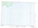
Maps showing Louisa D. Beach, Saint John, New Brunswick
Louisa D. Beach is a Beach located in Saint John, New Brunswick and has an elevation of 51 meters.
- Latitude: 45° 14' 40'' North (decimal: 45.2444531)
- Longitude: 65° 49' 46'' West (decimal: -65.8295647)
- Topography Feature Category: Beach
- Geographical Feature: Beach
- Canadian Province/Territory: New Brunswick
- Elevation: 51 meters
- Location: Saint John
- Atlas of Canada Locator Map: Louisa D. Beach
- GPS Coordinate Locator Map: Louisa D. Beach Lat/Long
Louisa D. Beach NTS Map Sheets