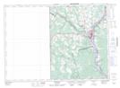
Maps showing Lower Brighton, Carleton, New Brunswick
Lower Brighton is a Unincorporated area located in Carleton, New Brunswick and has an elevation of 101 meters.
- Latitude: 46° 14' 48'' North (decimal: 46.2466407)
- Longitude: 67° 30' 00'' West (decimal: -67.4999969)
- Topography Feature Category: Unincorporated area
- Geographical Feature: Dispersed Rural Community
- Canadian Province/Territory: New Brunswick
- Elevation: 101 meters
- Location: Carleton
- Atlas of Canada Locator Map: Lower Brighton
- GPS Coordinate Locator Map: Lower Brighton Lat/Long
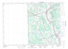
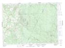
Lower Brighton NTS Map Sheets