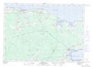
Maps showing West Brook, Westmorland, New Brunswick
West Brook is a River located in Westmorland, New Brunswick and has an elevation of 34 meters.
- Latitude: 46° 2' 49'' North (decimal: 46.0468390)
- Longitude: 64° 20' 31'' West (decimal: -64.3419338)
- Topography Feature Category: River
- Geographical Feature: Brook
- Canadian Province/Territory: New Brunswick
- Elevation: 34 meters
- Location: Westmorland
- Atlas of Canada Locator Map: West Brook
- GPS Coordinate Locator Map: West Brook Lat/Long