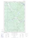
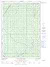
Maps showing McPherson Pond, Madawaska, New Brunswick
McPherson Pond is a Lake located in Madawaska, New Brunswick and has an elevation of 210 meters.
- Latitude: 47° 15' 1'' North (decimal: 47.2502865)
- Longitude: 69° 2' 30'' West (decimal: -69.0417603)
- Topography Feature Category: Lake
- Geographical Feature: Pond
- Canadian Province/Territory: New Brunswick
- Elevation: 210 meters
- Location: Madawaska
- Atlas of Canada Locator Map: McPherson Pond
- GPS Coordinate Locator Map: McPherson Pond Lat/Long
McPherson Pond NTS Map Sheets