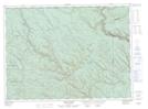
Maps showing Pollard Brook, Restigouche, New Brunswick
Pollard Brook is a River located in Restigouche, New Brunswick and has an elevation of 249 meters.
- Latitude: 47° 57' 27'' North (decimal: 47.9573665)
- Longitude: 67° 36' 51'' West (decimal: -67.6141807)
- Topography Feature Category: River
- Geographical Feature: Brook
- Canadian Province/Territory: New Brunswick
- Elevation: 249 meters
- Location: Restigouche
- Atlas of Canada Locator Map: Pollard Brook
- GPS Coordinate Locator Map: Pollard Brook Lat/Long
Pollard Brook NTS Map Sheets