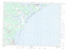
Maps showing Pont-Landry, Gloucester, New Brunswick
Pont-Landry is a Unincorporated area located in Gloucester, New Brunswick and has an elevation of 23 meters.
- Latitude: 47° 34' 32'' North (decimal: 47.5755531)
- Longitude: 64° 57' 17'' West (decimal: -64.9548023)
- Topography Feature Category: Unincorporated area
- Geographical Feature: Dispersed Rural Community
- Canadian Province/Territory: New Brunswick
- Elevation: 23 meters
- Location: Gloucester
- Atlas of Canada Locator Map: Pont-Landry
- GPS Coordinate Locator Map: Pont-Landry Lat/Long