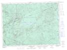
Maps showing Popple Depot, Northumberland, New Brunswick
Popple Depot is a Unincorporated area located in Northumberland, New Brunswick and has an elevation of 248 meters.
- Latitude: 47° 23' 52'' North (decimal: 47.3977770)
- Longitude: 66° 30' 39'' West (decimal: -66.5109312)
- Topography Feature Category: Unincorporated area
- Geographical Feature: Locality
- Canadian Province/Territory: New Brunswick
- Elevation: 248 meters
- Location: Northumberland
- Atlas of Canada Locator Map: Popple Depot
- GPS Coordinate Locator Map: Popple Depot Lat/Long
Popple Depot NTS Map Sheets