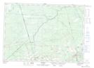
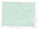
Maps showing Lipsett Brook, Westmorland, New Brunswick
Lipsett Brook is a River located in Westmorland, New Brunswick and has an elevation of 79 meters.
- Latitude: 46° 14' 15'' North (decimal: 46.2375976)
- Longitude: 65° 4' 24'' West (decimal: -65.0733076)
- Topography Feature Category: River
- Geographical Feature: Brook
- Canadian Province/Territory: New Brunswick
- Elevation: 79 meters
- Location: Westmorland
- Atlas of Canada Locator Map: Lipsett Brook
- GPS Coordinate Locator Map: Lipsett Brook Lat/Long
Lipsett Brook NTS Map Sheets