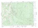
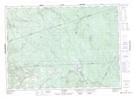
Maps showing Little Clearwater Brook, Carleton, New Brunswick
Little Clearwater Brook is a River located in Carleton, New Brunswick and has an elevation of 304 meters.
- Latitude: 46° 30' 36'' North (decimal: 46.509949)
- Longitude: 67° 11' 19'' West (decimal: -67.1884905)
- Topography Feature Category: River
- Geographical Feature: Brook
- Canadian Province/Territory: New Brunswick
- Elevation: 304 meters
- Location: Carleton
- Atlas of Canada Locator Map: Little Clearwater Brook
- GPS Coordinate Locator Map: Little Clearwater Brook Lat/Long
Little Clearwater Brook NTS Map Sheets