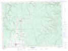
Maps showing Little Five Finger Brook, Restigouche, New Brunswick
Little Five Finger Brook is a River located in Restigouche, New Brunswick and has an elevation of 207 meters.
- Latitude: 47° 35' 9'' North (decimal: 47.5859197)
- Longitude: 67° 25' 52'' West (decimal: -67.4311933)
- Topography Feature Category: River
- Geographical Feature: Brook
- Canadian Province/Territory: New Brunswick
- Elevation: 207 meters
- Location: Restigouche
- Atlas of Canada Locator Map: Little Five Finger Brook
- GPS Coordinate Locator Map: Little Five Finger Brook Lat/Long
Little Five Finger Brook NTS Map Sheets