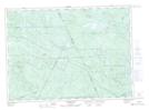
Maps showing Upper Kennedy Lake, Northumberland, New Brunswick
Upper Kennedy Lake is a Lake located in Northumberland, New Brunswick and has an elevation of 345 meters.
- Latitude: 46° 50' 38'' North (decimal: 46.8438502)
- Longitude: 66° 30' 28'' West (decimal: -66.5076485)
- Topography Feature Category: Lake
- Geographical Feature: Lake
- Canadian Province/Territory: New Brunswick
- Elevation: 345 meters
- Location: Northumberland
- Atlas of Canada Locator Map: Upper Kennedy Lake
- GPS Coordinate Locator Map: Upper Kennedy Lake Lat/Long
Upper Kennedy Lake NTS Map Sheets