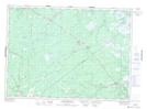
Maps showing Upper Napan, Northumberland, New Brunswick
Upper Napan is a Unincorporated area located in Northumberland, New Brunswick and has an elevation of 19 meters.
- Latitude: 46° 59' 50'' North (decimal: 46.9972601)
- Longitude: 65° 25' 41'' West (decimal: -65.4280558)
- Topography Feature Category: Unincorporated area
- Geographical Feature: Dispersed Rural Community
- Canadian Province/Territory: New Brunswick
- Elevation: 19 meters
- Location: Northumberland
- Atlas of Canada Locator Map: Upper Napan
- GPS Coordinate Locator Map: Upper Napan Lat/Long
Upper Napan NTS Map Sheets