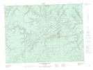
Maps showing Upper Twenty Mile Gulch, Restigouche, New Brunswick
Upper Twenty Mile Gulch is a Valley located in Restigouche, New Brunswick and has an elevation of 206 meters.
- Latitude: 47° 38' 39'' North (decimal: 47.6440615)
- Longitude: 66° 57' 46'' West (decimal: -66.9627386)
- Topography Feature Category: Valley
- Geographical Feature: Gulch
- Canadian Province/Territory: New Brunswick
- Elevation: 206 meters
- Location: Restigouche
- Atlas of Canada Locator Map: Upper Twenty Mile Gulch
- GPS Coordinate Locator Map: Upper Twenty Mile Gulch Lat/Long
Upper Twenty Mile Gulch NTS Map Sheets