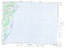
Maps showing Val Comeau Provincial Park, Gloucester, New Brunswick
Val Comeau Provincial Park is a Conservation area located in Gloucester, New Brunswick and has an elevation of 2 meters.
- Latitude: 47° 28' 24'' North (decimal: 47.4733224)
- Longitude: 64° 52' 20'' West (decimal: -64.8723316)
- Topography Feature Category: Conservation area
- Geographical Feature: Provincial Park
- Canadian Province/Territory: New Brunswick
- Elevation: 2 meters
- Location: Gloucester
- Atlas of Canada Locator Map: Val Comeau Provincial Park
- GPS Coordinate Locator Map: Val Comeau Provincial Park Lat/Long
Val Comeau Provincial Park NTS Map Sheets