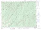
Maps showing Veneer, Madawaska, New Brunswick
Veneer is a Unincorporated area located in Madawaska, New Brunswick and has an elevation of 213 meters.
- Latitude: 47° 18' 42'' North (decimal: 47.3116850)
- Longitude: 67° 42' 46'' West (decimal: -67.7126798)
- Topography Feature Category: Unincorporated area
- Geographical Feature: Railway Point
- Canadian Province/Territory: New Brunswick
- Elevation: 213 meters
- Location: Madawaska
- Atlas of Canada Locator Map: Veneer
- GPS Coordinate Locator Map: Veneer Lat/Long
Veneer NTS Map Sheets