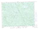
Maps showing Little North Branch Renous River, Northumberland, New Brunswick
Little North Branch Renous River is a River located in Northumberland, New Brunswick and has an elevation of 405 meters.
- Latitude: 46° 53' 51'' North (decimal: 46.8974751)
- Longitude: 66° 37' 35'' West (decimal: -66.6264242)
- Topography Feature Category: River
- Geographical Feature: Branch
- Canadian Province/Territory: New Brunswick
- Elevation: 405 meters
- Location: Northumberland
- Atlas of Canada Locator Map: Little North Branch Renous River
- GPS Coordinate Locator Map: Little North Branch Renous River Lat/Long
Little North Branch Renous River NTS Map Sheets