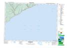
Maps showing Little Salmon River, Saint John, New Brunswick
Little Salmon River is a River located in Saint John, New Brunswick and has an elevation of 71 meters.
- Latitude: 45° 28' 25'' North (decimal: 45.4735680)
- Longitude: 65° 16' 41'' West (decimal: -65.2779309)
- Topography Feature Category: River
- Geographical Feature: River
- Canadian Province/Territory: New Brunswick
- Elevation: 71 meters
- Location: Saint John
- Atlas of Canada Locator Map: Little Salmon River
- GPS Coordinate Locator Map: Little Salmon River Lat/Long
Little Salmon River NTS Map Sheets