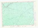
Maps showing Little South Branch Muzroll Brook, Northumberland, New Brunswick
Little South Branch Muzroll Brook is a River located in Northumberland, New Brunswick and has an elevation of 105 meters.
- Latitude: 46° 27' 56'' North (decimal: 46.4656219)
- Longitude: 66° 5' 19'' West (decimal: -66.0887324)
- Topography Feature Category: River
- Geographical Feature: Branch
- Canadian Province/Territory: New Brunswick
- Elevation: 105 meters
- Location: Northumberland
- Atlas of Canada Locator Map: Little South Branch Muzroll Brook
- GPS Coordinate Locator Map: Little South Branch Muzroll Brook Lat/Long
Little South Branch Muzroll Brook NTS Map Sheets