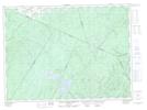
Maps showing Big Cedar Brook, Restigouche, New Brunswick
Big Cedar Brook is a River located in Restigouche, New Brunswick and has an elevation of 220 meters.
- Latitude: 47° 27' 24'' North (decimal: 47.4566882)
- Longitude: 67° 3' 35'' West (decimal: -67.0597322)
- Topography Feature Category: River
- Geographical Feature: Brook
- Canadian Province/Territory: New Brunswick
- Elevation: 220 meters
- Location: Restigouche
- Atlas of Canada Locator Map: Big Cedar Brook
- GPS Coordinate Locator Map: Big Cedar Brook Lat/Long
Big Cedar Brook NTS Map Sheets