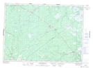
Maps showing Big Hovel Brook, Northumberland, New Brunswick
Big Hovel Brook is a River located in Northumberland, New Brunswick and has an elevation of 55 meters.
- Latitude: 46° 49' 21'' North (decimal: 46.822558)
- Longitude: 65° 20' 50'' West (decimal: -65.3472389)
- Topography Feature Category: River
- Geographical Feature: Brook
- Canadian Province/Territory: New Brunswick
- Elevation: 55 meters
- Location: Northumberland
- Atlas of Canada Locator Map: Big Hovel Brook
- GPS Coordinate Locator Map: Big Hovel Brook Lat/Long
Big Hovel Brook NTS Map Sheets