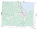
Maps showing Big Narrows, Gloucester, New Brunswick
Big Narrows is a Channel located in Gloucester, New Brunswick and has an elevation of 191 meters.
- Latitude: 47° 37' 36'' North (decimal: 47.6267439)
- Longitude: 65° 58' 2'' West (decimal: -65.9672185)
- Topography Feature Category: Channel
- Geographical Feature: Narrows
- Canadian Province/Territory: New Brunswick
- Elevation: 191 meters
- Location: Gloucester
- Atlas of Canada Locator Map: Big Narrows
- GPS Coordinate Locator Map: Big Narrows Lat/Long