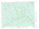
Maps showing Birch Island, York, New Brunswick
Birch Island is a Island located in York, New Brunswick and has an elevation of 246 meters.
- Latitude: 46° 31' 0'' North (decimal: 46.5168027)
- Longitude: 66° 56' 19'' West (decimal: -66.9384907)
- Topography Feature Category: Island
- Geographical Feature: Island
- Canadian Province/Territory: New Brunswick
- Elevation: 246 meters
- Location: York
- Atlas of Canada Locator Map: Birch Island
- GPS Coordinate Locator Map: Birch Island Lat/Long
Birch Island NTS Map Sheets