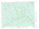
Maps showing Grassy Island, York, New Brunswick
Grassy Island is a Island located in York, New Brunswick and has an elevation of 227 meters.
- Latitude: 46° 35' 2'' North (decimal: 46.5838884)
- Longitude: 66° 42' 33'' West (decimal: -66.7092046)
- Topography Feature Category: Island
- Geographical Feature: Island
- Canadian Province/Territory: New Brunswick
- Elevation: 227 meters
- Location: York
- Atlas of Canada Locator Map: Grassy Island
- GPS Coordinate Locator Map: Grassy Island Lat/Long
Grassy Island NTS Map Sheets