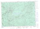
Maps showing Mount Gray, Northumberland, New Brunswick
Mount Gray is a Mountain located in Northumberland, New Brunswick and has an elevation of 618 meters.
- Latitude: 47° 15' 59'' North (decimal: 47.2662856)
- Longitude: 66° 37' 38'' West (decimal: -66.6271375)
- Topography Feature Category: Mountain
- Geographical Feature: Mount
- Canadian Province/Territory: New Brunswick
- Elevation: 618 meters
- Location: Northumberland
- Atlas of Canada Locator Map: Mount Gray
- GPS Coordinate Locator Map: Mount Gray Lat/Long
Mount Gray NTS Map Sheets