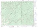
Maps showing Grindstone Brook, Victoria, New Brunswick
Grindstone Brook is a River located in Victoria, New Brunswick and has an elevation of 302 meters.
- Latitude: 47° 17' 21'' North (decimal: 47.2891743)
- Longitude: 67° 30' 34'' West (decimal: -67.5095567)
- Topography Feature Category: River
- Geographical Feature: Brook
- Canadian Province/Territory: New Brunswick
- Elevation: 302 meters
- Location: Victoria
- Atlas of Canada Locator Map: Grindstone Brook
- GPS Coordinate Locator Map: Grindstone Brook Lat/Long
Grindstone Brook NTS Map Sheets