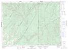
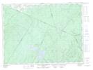
Maps showing Grindstone Gulch, Victoria, New Brunswick
Grindstone Gulch is a Valley located in Victoria, New Brunswick and has an elevation of 241 meters.
- Latitude: 47° 28' 48'' North (decimal: 47.4800916)
- Longitude: 67° 29' 47'' West (decimal: -67.4963199)
- Topography Feature Category: Valley
- Geographical Feature: Gulch
- Canadian Province/Territory: New Brunswick
- Elevation: 241 meters
- Location: Victoria
- Atlas of Canada Locator Map: Grindstone Gulch
- GPS Coordinate Locator Map: Grindstone Gulch Lat/Long
Grindstone Gulch NTS Map Sheets