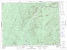
Maps showing Blackguard Island, Victoria, New Brunswick
Blackguard Island is a Island located in Victoria, New Brunswick and has an elevation of 183 meters.
- Latitude: 47° 11' 34'' North (decimal: 47.1928665)
- Longitude: 67° 11' 57'' West (decimal: -67.1991964)
- Topography Feature Category: Island
- Geographical Feature: Island
- Canadian Province/Territory: New Brunswick
- Elevation: 183 meters
- Location: Victoria
- Atlas of Canada Locator Map: Blackguard Island
- GPS Coordinate Locator Map: Blackguard Island Lat/Long
Blackguard Island NTS Map Sheets