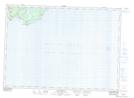
Maps showing Black Rock, Saint John, New Brunswick
Black Rock is a Shoal located in Saint John, New Brunswick and has an elevation of 2 meters.
- Latitude: 45° 12' 20'' North (decimal: 45.2055198)
- Longitude: 65° 56' 58'' West (decimal: -65.9494165)
- Topography Feature Category: Shoal
- Geographical Feature: Rock
- Canadian Province/Territory: New Brunswick
- Elevation: 2 meters
- Location: Saint John
- Atlas of Canada Locator Map: Black Rock
- GPS Coordinate Locator Map: Black Rock Lat/Long
Black Rock NTS Map Sheets