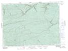
Maps showing Black Top Mountain, Restigouche, New Brunswick
Black Top Mountain is a Mountain located in Restigouche, New Brunswick and has an elevation of 442 meters.
- Latitude: 47° 42' 56'' North (decimal: 47.7156651)
- Longitude: 66° 24' 33'' West (decimal: -66.4090585)
- Topography Feature Category: Mountain
- Geographical Feature: Mountain
- Canadian Province/Territory: New Brunswick
- Elevation: 442 meters
- Location: Restigouche
- Atlas of Canada Locator Map: Black Top Mountain
- GPS Coordinate Locator Map: Black Top Mountain Lat/Long
Black Top Mountain NTS Map Sheets