Maps showing Bloomfield Ridge, York, New Brunswick
Bloomfield Ridge is a Unincorporated area located in York, New Brunswick and has an elevation of 99 meters.
- Latitude: 46° 28' 58'' North (decimal: 46.4827862)
- Longitude: 66° 29' 9'' West (decimal: -66.4857877)
- Topography Feature Category: Unincorporated area
- Geographical Feature: Dispersed Rural Community
- Canadian Province/Territory: New Brunswick
- Elevation: 99 meters
- Location: York
- Atlas of Canada Locator Map: Bloomfield Ridge
- GPS Coordinate Locator Map: Bloomfield Ridge Lat/Long
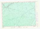
Bloomfield Ridge NTS Map Sheets