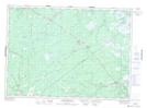
Maps showing Blue Ridge Plain, Kent, New Brunswick
Blue Ridge Plain is a Low vegetation located in Kent, New Brunswick and has an elevation of 38 meters.
- Latitude: 46° 53' 46'' North (decimal: 46.8961051)
- Longitude: 65° 3' 4'' West (decimal: -65.0511274)
- Topography Feature Category: Low vegetation
- Geographical Feature: Plain
- Canadian Province/Territory: New Brunswick
- Elevation: 38 meters
- Location: Kent
- Atlas of Canada Locator Map: Blue Ridge Plain
- GPS Coordinate Locator Map: Blue Ridge Plain Lat/Long
Blue Ridge Plain NTS Map Sheets