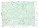
Maps showing Crooked Rapids, Carleton, New Brunswick
Crooked Rapids is a Rapids located in Carleton, New Brunswick and has an elevation of 256 meters.
- Latitude: 46° 30' 43'' North (decimal: 46.5119069)
- Longitude: 67° 6' 45'' West (decimal: -67.1125713)
- Topography Feature Category: Rapids
- Geographical Feature: Rapids
- Canadian Province/Territory: New Brunswick
- Elevation: 256 meters
- Location: Carleton
- Atlas of Canada Locator Map: Crooked Rapids
- GPS Coordinate Locator Map: Crooked Rapids Lat/Long